What if...?
...we can make the site easier to access and get around without a car?
The Challenge:
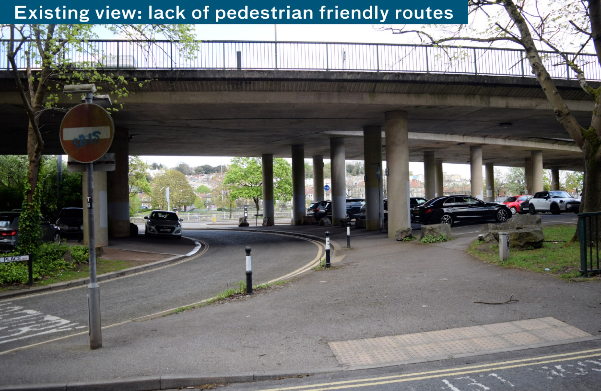
The site is largely geared towards vehicle movement and harbour operations. This results in a poor experience for pedestrians and cyclists and makes the area difficult to navigate.
We’re exploring how to better connect with the wider city to allow everyone to travel across the site easily.
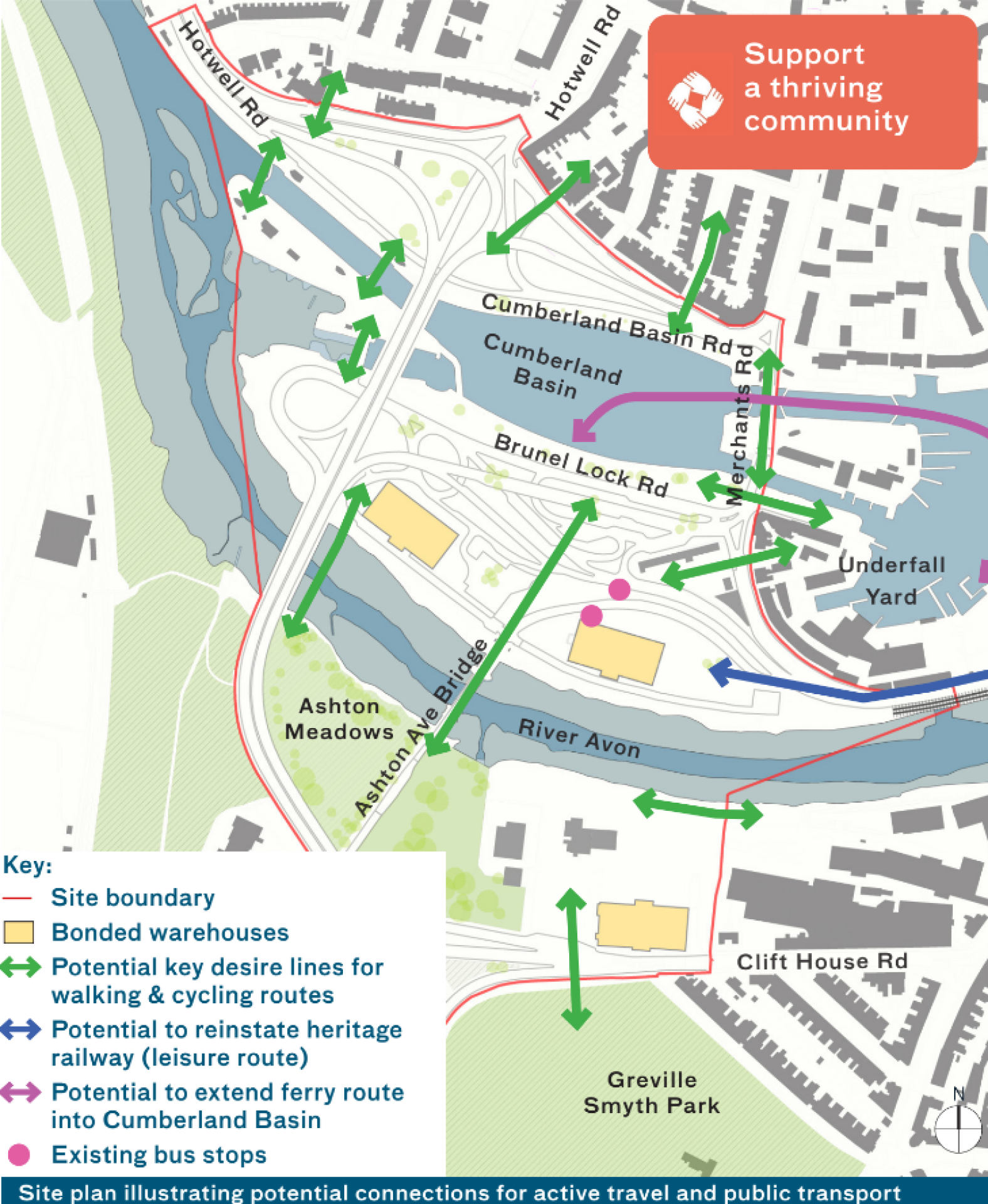
For the masterplan we will need to:
- review existing pedestrian routes and crossing points
- consider the relationship with harbour operations and traffic movement
- consider destinations and places of interest
- review how we connect new and existing communities to the north, south and east
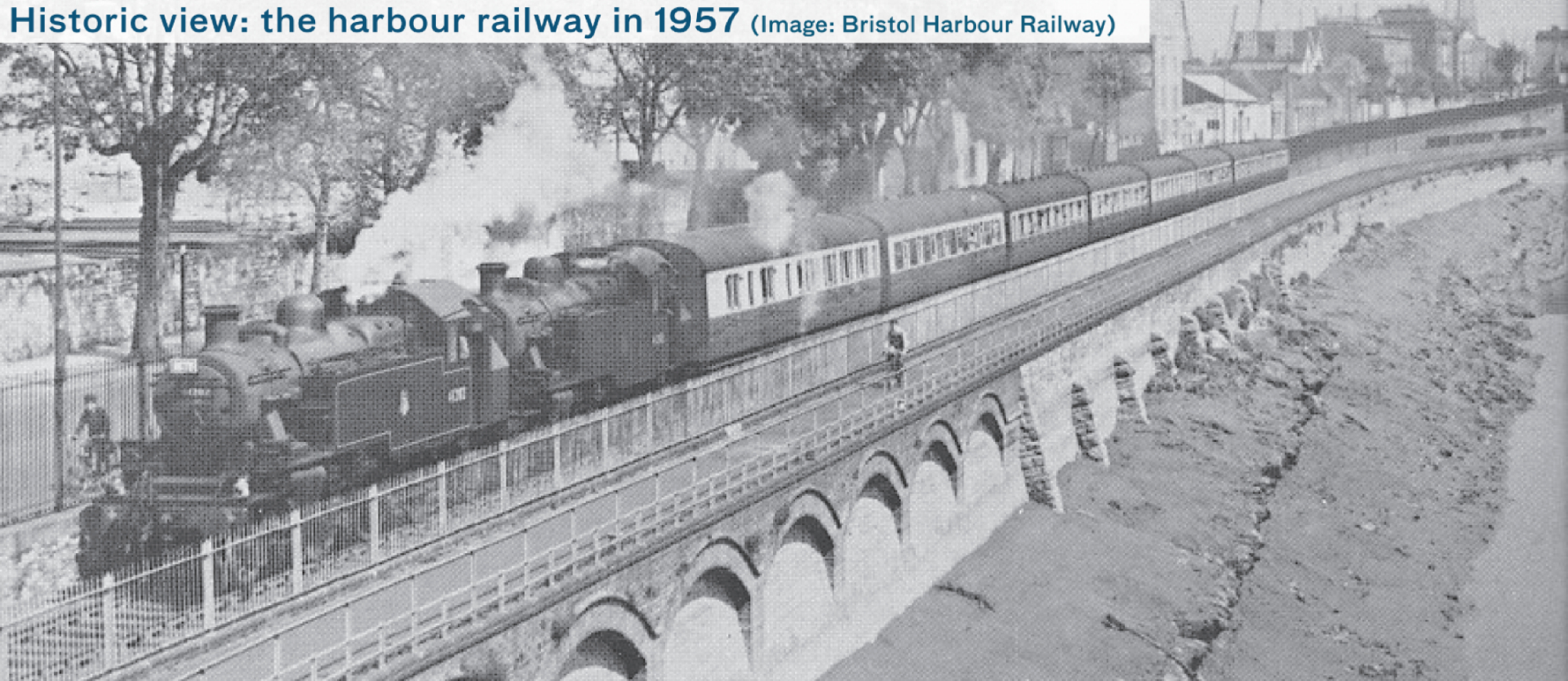
- consider if we can reinstate the heritage railway, extending its route into the site
- consider the potential to extend the existing ferry route to Cumberland Basin
Click image to enlarge
Click image to enlarge
Click image to enlarge
Click image to enlarge
Give your view on connectivity