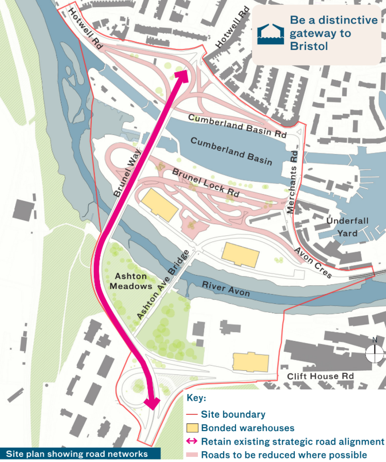
What if...?
...Brunel Way remains where it is and the spaghetti of diversion roads are reduced to make room for other uses such as new homes?
The Challenge:
The existing 1960s road network is aging. We are investigating whether we need to replace this infrastructure or if it can be repaired and simplified.
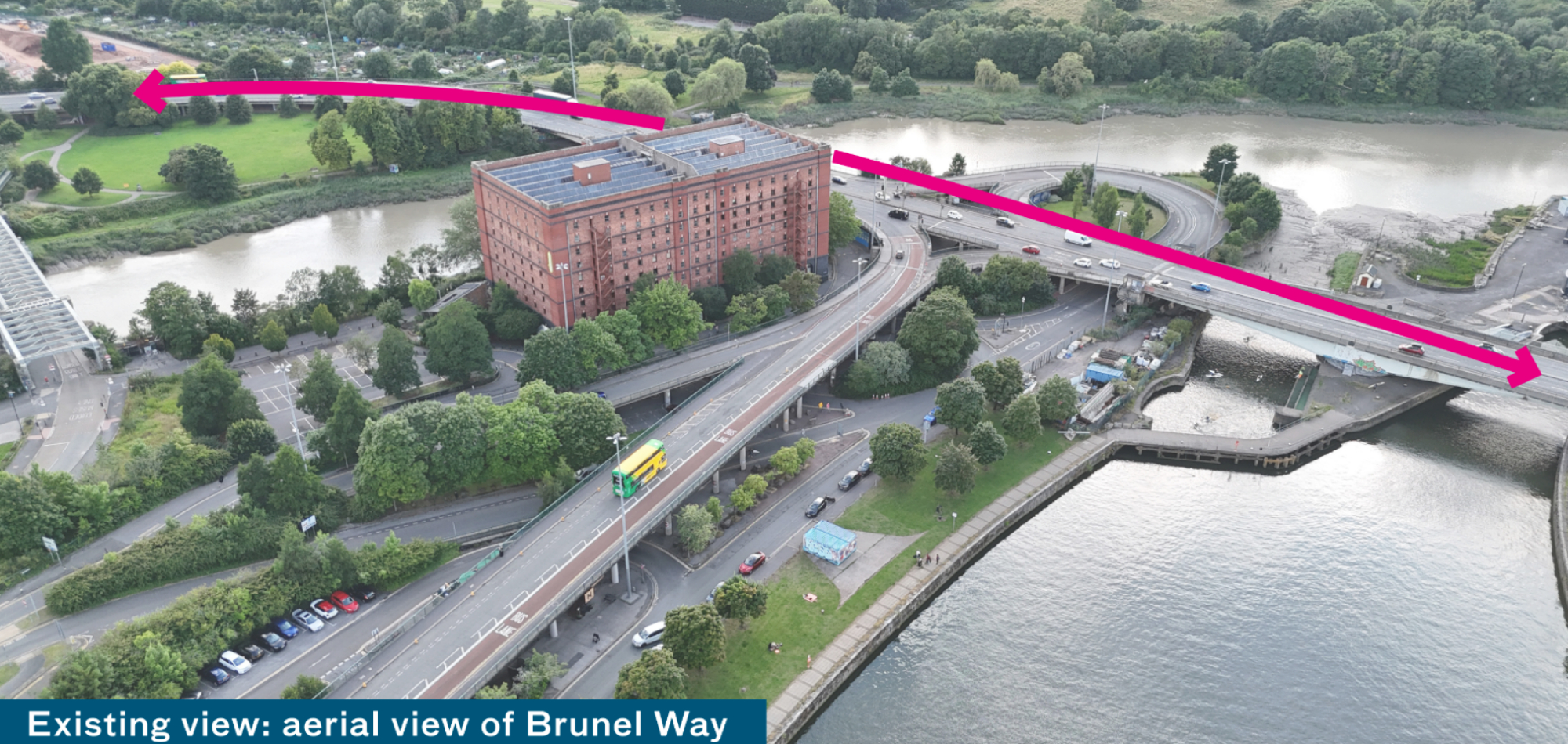
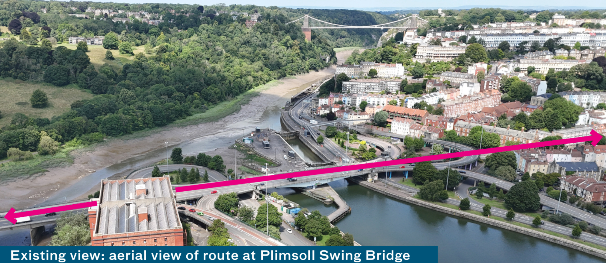
Rather than looking at new crossings, we are exploring keeping the main strategic route in its current location.
We believe retaining the current alignment should be explored as it will minimise disruption, cost and carbon emissions.
Surveys and research are currently taking place to understand how the roads are used by the public, logistics and public transport, as well as the current condition of the elevated roads and bridges.
For the masterplan we will need to:
- consider how much of the existing road spaghetti can be removed whilst maintaining a strategic route in and out of the city
- consider what happens to traffic when the Plimsoll Swing Bridge is open
- test traffic movement
- consider local access arrangements
- liaise with emergency services
- consider the outcome of structural surveys
- consider how to minimise disruption to traffic flows during construction
Click image to enlarge
Click image to enlarge
Click image to enlarge
Give your view on road alignment