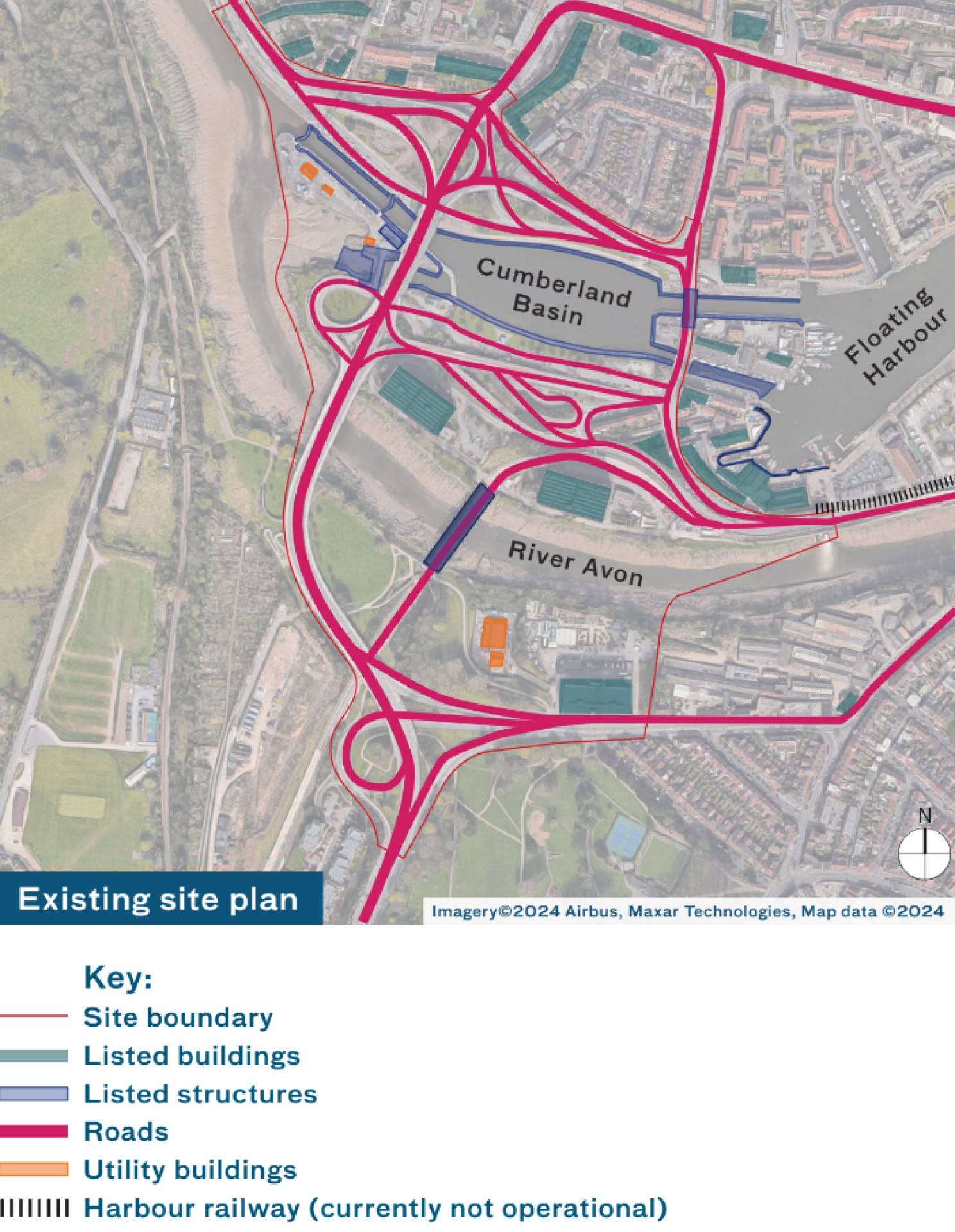
The site is very complex and we are still learning about it. Through site research and technical surveys, we are understanding the traffic flows, flooding challenges, harbour operations, heritage constraints and the condition of the road infrastructure. The findings of these technical studies will be taken into account along with your feedback to inform the masterplan. These surveys are ongoing and more research will be conducted.
Infrastructure
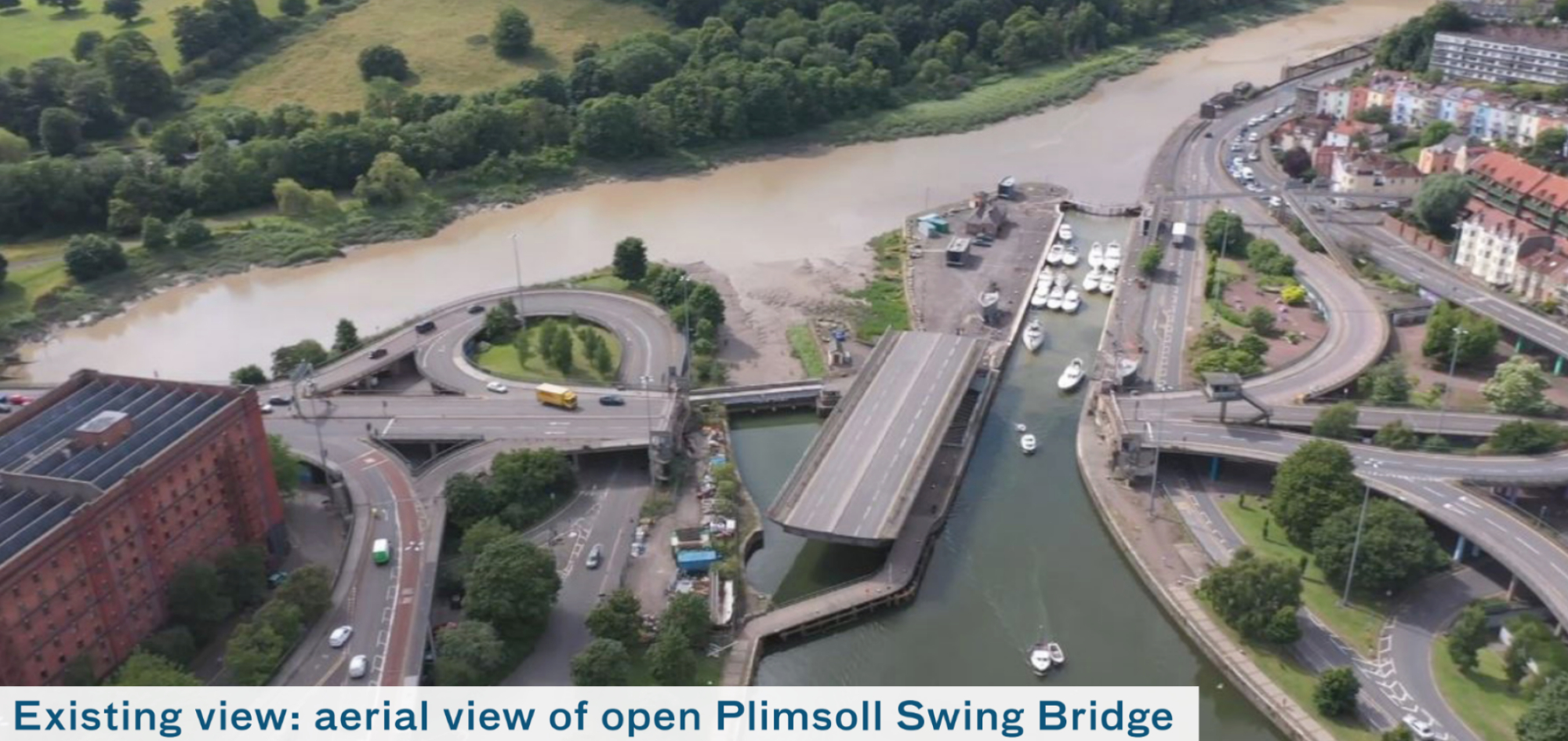
In the 1960s a new road network was introduced, including the Plimsoll Swing Bridge, carrying traffic into the city centre - an average of 51,000 cars a day. This spaghetti of elevated roads includes diversion routes for road traffic when the bridge swings to allow boats into the harbour.
Plimsoll Swing Bridge actually does not swing very frequently. At peak season, during July when the Harbour Festival occurs, it swings roughly 53 times. However, it swings roughly three times in January. When it does swing, on average it takes 10-12 minutes to open and close.
The majority of the existing highway infrastructure is 60 years old, combined with harbour assets such as the Junction Lock Swing Bridge and the harbour structures themselves dating from the 1800s.
Not all of the roads are well used. Ongoing surveys will help determine the life expectancy of the existing structures and inform our decision making.
Click image to enlarge
Click image to enlarge
Heritage: listed buildings and structures
The western end of the floating harbour has evolved over the centuries, seeing feats of engineering, the changing fortunes of dock workers, and becoming a key route in and out of Bristol.
The lock gates and harbour walls are listed along with the pedestrian swing bridge known as Brunel’s Other Bridge.
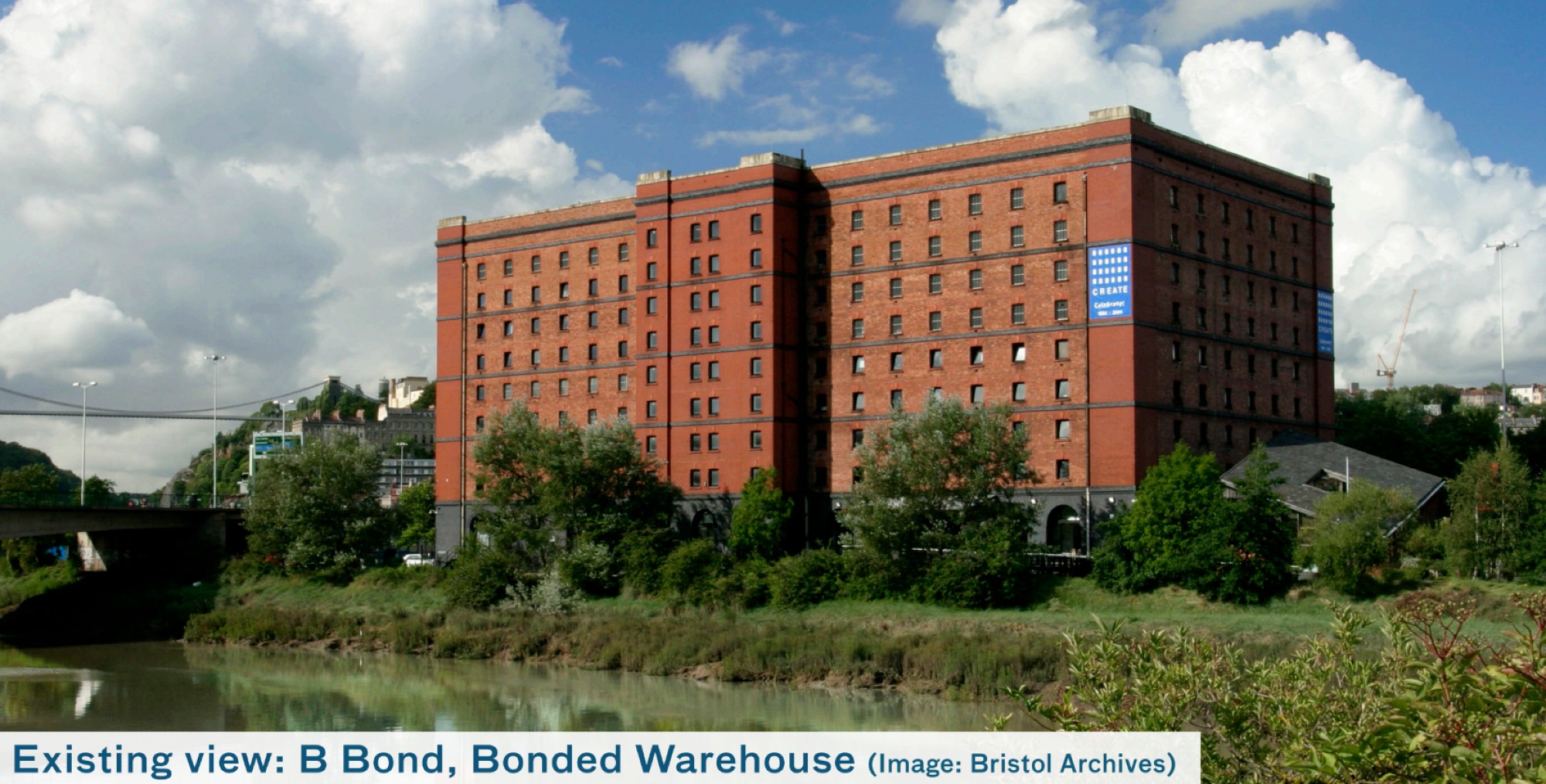
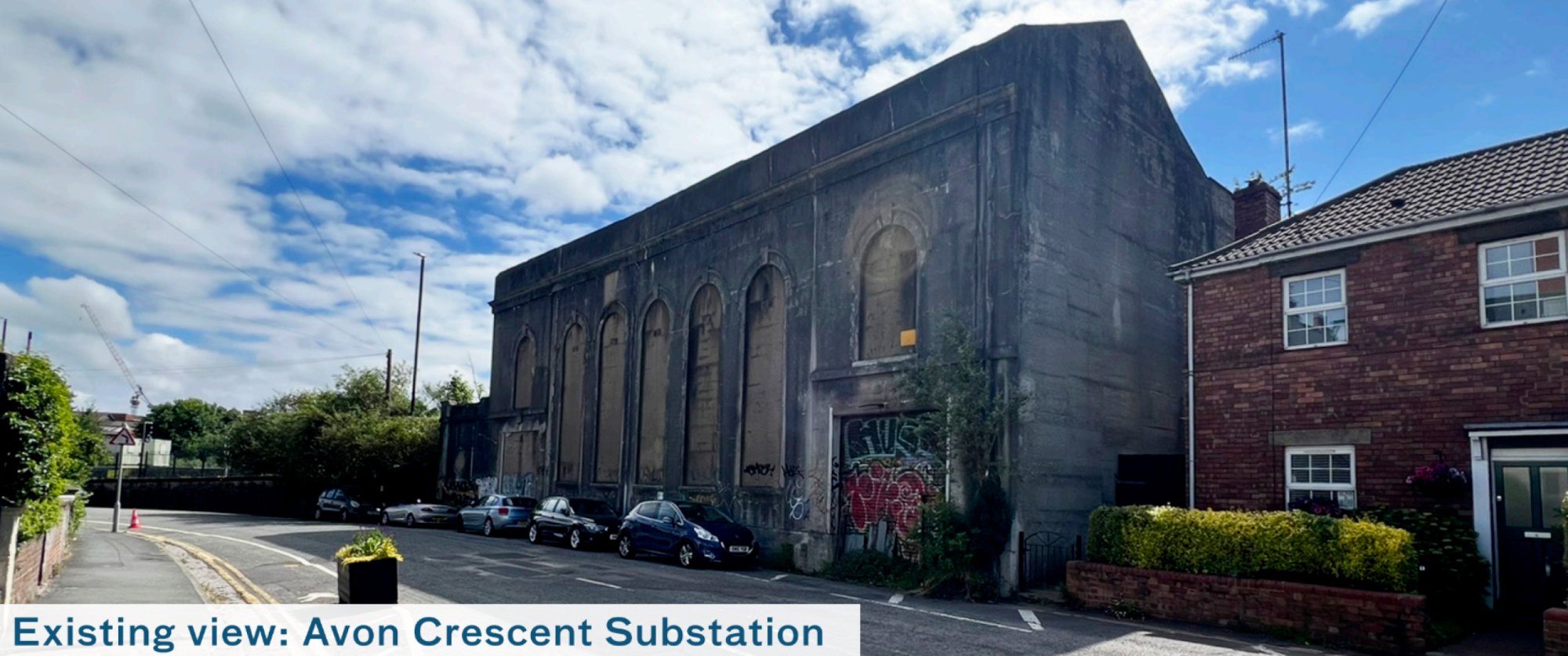
The three bonded warehouses are Grade II listed, built in the early 20th Century and used to store tobacco. Now they house a mixture of uses including the Create Centre and a storage company. Some of the other listed elements include:
- Avon Crescent Substation
- Ashton Avenue Bridge
- South Entrance Lock
Click image to enlarge
Click image to enlarge
Ecology and landscape
The site contains landscape designed by the acclaimed landscape architect Dame Sylvia Crowe, including a lookout point with views towards the Clifton Suspension Bridge.
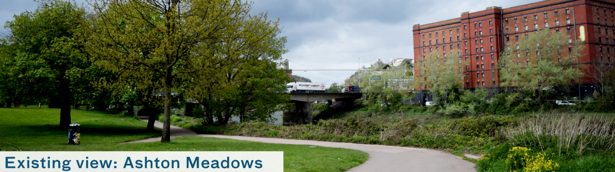
In the south of the site, Ashton Meadows provides the surrounding community with green space that has a self-built skate park and is surrounded by mature trees, adjacent to where the Riverside Garden Centre is located.
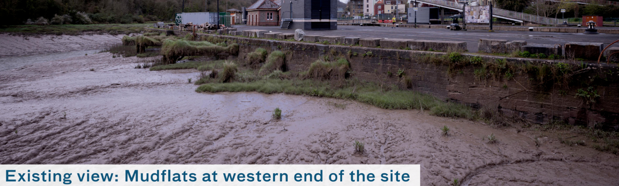
Ongoing studies include understanding the mudflats, surrounding ecology and considering the conditions of the existing trees.
Click image to enlarge
Click image to enlarge
Click image to enlarge
Water - a working harbour
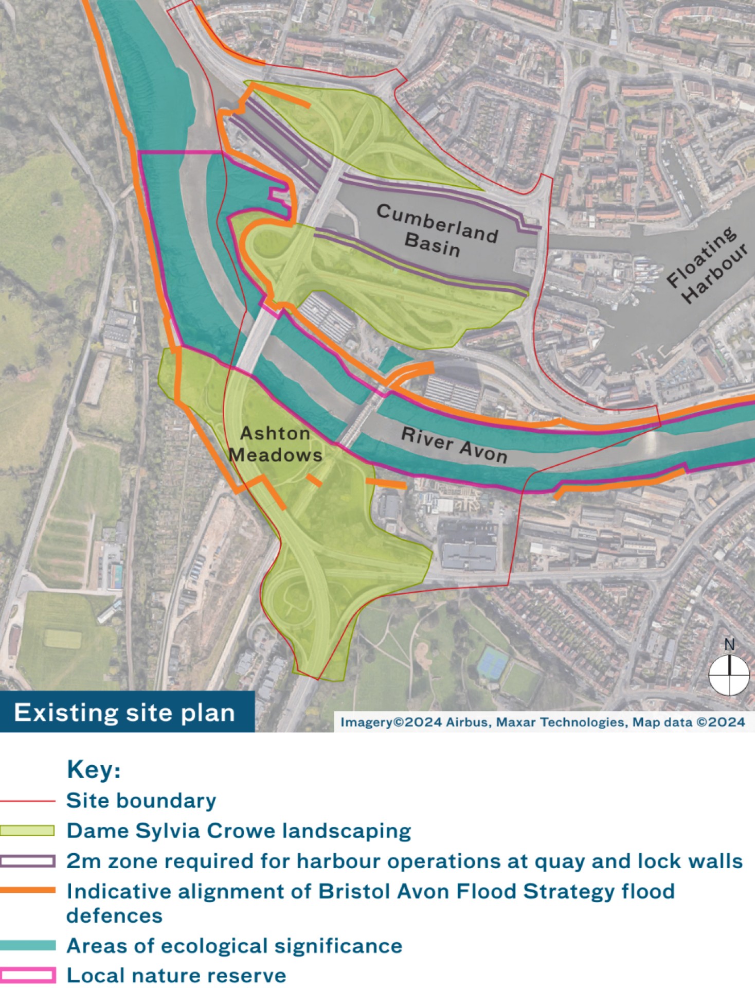
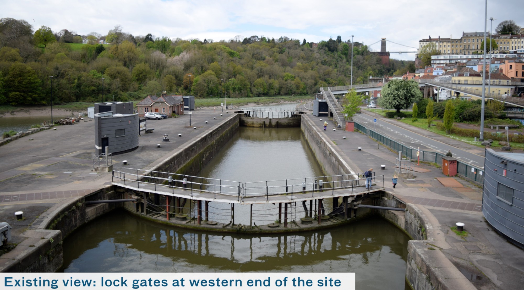
The majority of the area is situated within the Statutory Harbour Authority estate. There is a statutory right of navigation through the harbour. Waterborne craft enter/ exit the harbour via Entrance Lock which sits adjacent to Plimsoll Swing Bridge. Space around the lock gates and quayside is required to allow the safe operation of the harbour.
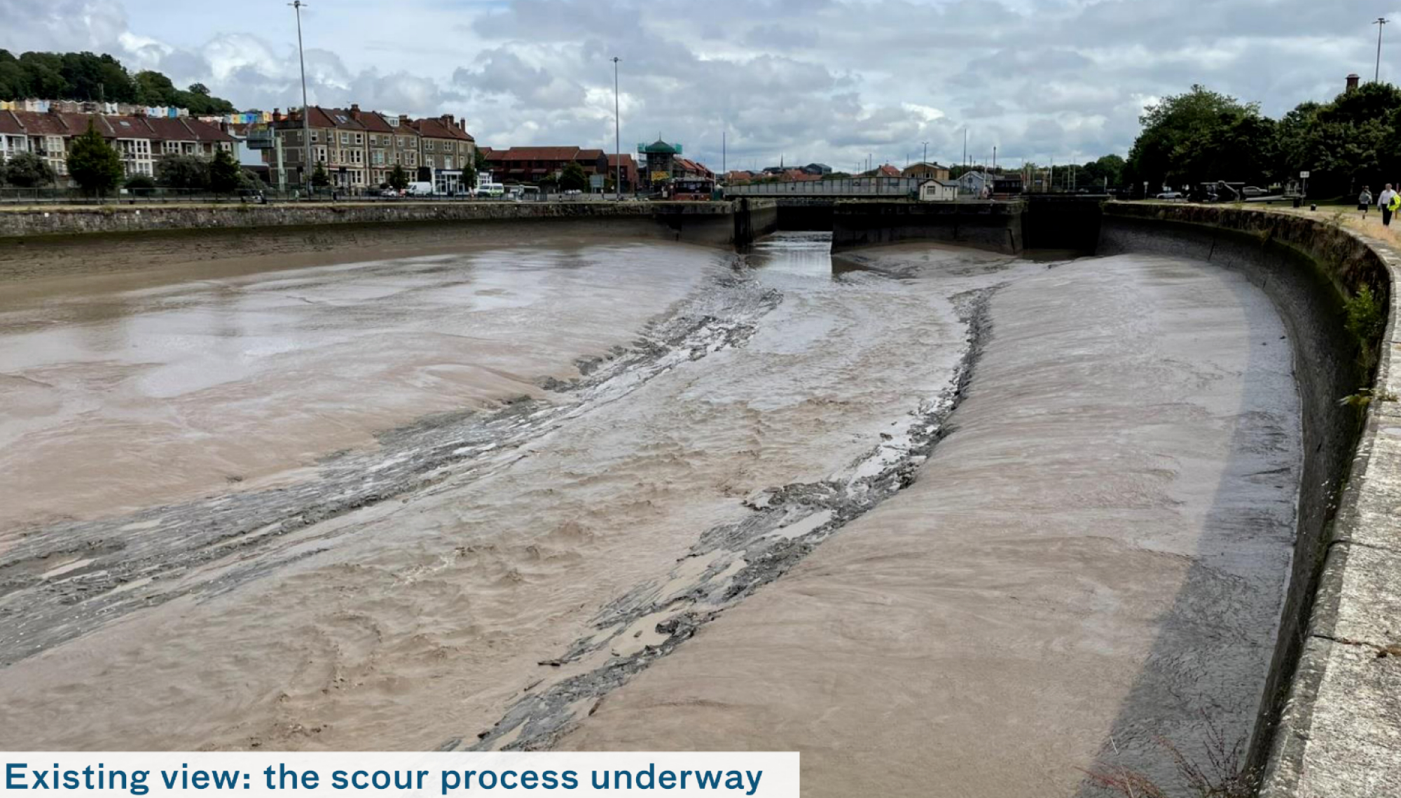
Cumberland Basin is an important feature of the harbour. It provides space for vessels to be held when they are waiting for the lock gates and swing bridges to open. Crucially, it is also designed to be “scoured” (which happens around twice a month) to remove silt buildup in the basin and prevent it from obstructing navigation. Lock gates regularly control the levels of water within the floating harbour, as well as ensuring that there is enough water in Cumberland Basin to carry out the regular scouring process and remove silt.
At the eastern end of Cumberland Basin there are two pairs of lock gates, which form a barrier to high river water levels. However, due to climate change, these gates can become overwhelmed, risking flooding within the centre of Bristol. To safeguard lives and property in Western Harbour and beyond, it’s imperative that we implement robust flood defences. These defences will not only shield the local area but also serve as a crucial line of defence for the entire city.
Click image to enlarge
Click image to enlarge
Read further background information on the project
Give your view on what we know so far